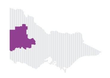
Wimmera Southern Mallee
The Wimmera Southern Mallee region falls within the traditional lands of the Wotjobaluk, Jaadwa, Jadawadjali, Wergaia, Jupagulk, Tjap Warrung, Dja Dja Wurrung and Gunditj Mirring Peoples.
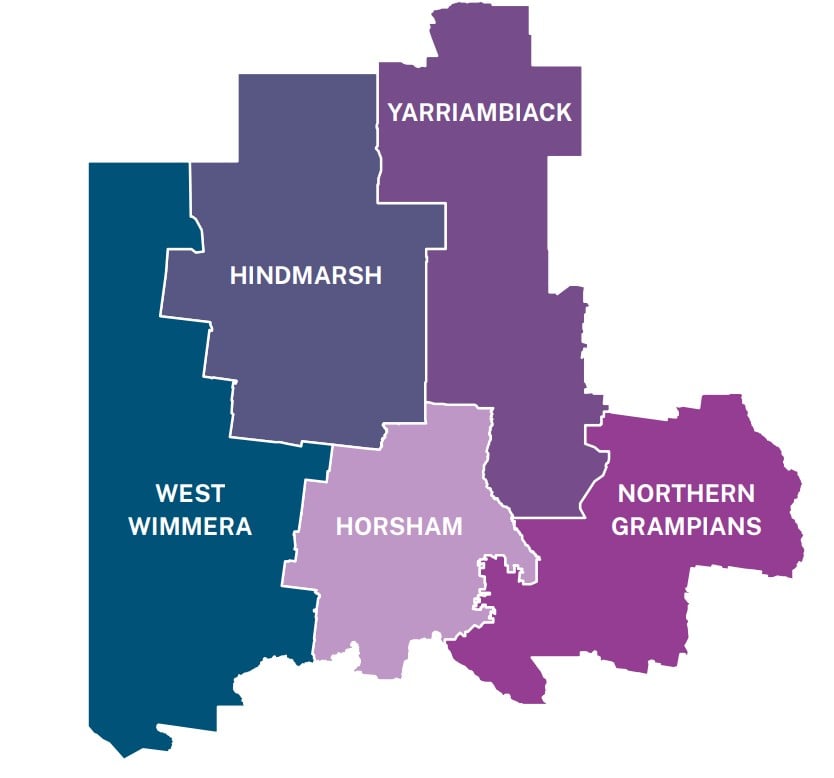
Wimmera Southern Mallee’s many small, yet vibrant, communities are served by the regional centres of Horsham and Stawell. Farms and communities are relatively remote, with the West Wimmera and Hindmarsh shires having the lowest and second lowest population densities, respectively, in Victoria.
The region has some of Victoria’s iconic natural attractions, including the Grampians National Park, the Wimmera River, major deserts, wetlands and lakes.
The region contains large grain growing areas, with broadacre cropping and livestock (mostly sheep and lamb) the primary land uses. In the West Wimmera shire, more than half the population works in agriculture and agriculture is also a major source of employment in the Hindmarsh and Yarriambiack shires.
The Wimmera Southern Mallee Drought Resilience Plan was produced collaboratively by a wide range of local residents, groups and organisations. A Drought Resilience Reference Group was established to steer the Plan’s development. The group included key stakeholders with expertise in agriculture, regional development, water, governance, community and natural resource management.
Implementing activities in the Wimmera Southern Mallee
Wimmera Southern Mallee Development (WSMD) is the Phase One Plan Coordinator for the Wimmera Southern Mallee region, receiving a $380,000 Implementation Grant to coordinate and deliver resilience building activities across the region.
WSMD successfully delivered 6 activities including:
- Hot Property – a regionally significant report that assessed the condition, resilience and retrofit viability of existing housing stock in 5 representative Wimmera towns under future climate conditions. It integrated site inspections, demographic and housing data, expert design assessment, and financial modelling to inform future climate-adaptive housing investments.
- Energy and Agriculture – Resilient Farming – a series of research projects by independent consultants to answer common questions being raised by the community and to support landholders make informed decisions about their involvement in wind energy projects. Research was presented at an information day in September 2024 and via a series of webinars.
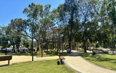
- Midday at the Oasis’ – Resilient Green Spaces – a report that identified and assessed priority community Green Spaces across 6 Wimmera-Southern Mallee council areas, highlighting development potential and gaps. It also included an audit and competitive assessment of shovel-ready projects within these areas.
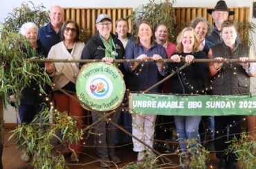
- ‘We’re Better Together’ Partnership Network – partnering with Western Victoria Primary Health Network and Harrow Bush Nursing Centre, the activity established a volunteer partnership, connecting residents of the small community of Harrow and surrounding districts. More than 200 participants – in a community of roughly 650 people – attended local events in June-July 2025, including community barbecues, wellbeing workshops, book-making for kids and a high tea.
- Action Stations – to improve the use and understanding of weather and soil moisture data published on the Wimmera Catchment Management Authority’s soil moisture portal. The activity used a portal user survey, interviews and data analysis to determine current use of the portal, then delivered findings to inform measures to increase use of the portal and improve its functionality and users’ data literacy. The first issue of the Soil Moisture Newsletter (Winter 2025) is one of these early measures.
- Drought-Ready Think Tank – a event in Horsham in July 2025 to showcase and celebrate the 11 recent and ongoing drought preparedness and resilience projects in the region funded through the RDRP program and also the Future Drought Fund’s Communities program. The event also provided captured the input of the 40 attendees to inform the next steps the region to further strengthen drought preparedness.