Goulburn
Taungurung, Wurundjeri and Yorta Yorta First Nations peoples have lived in the Goulburn region for over 60,000 years, with deep connections to Country and the natural environment through traditional knowledge, spiritual beliefs and cultural practices. The region is home to the largest First Nations population in regional Victoria.
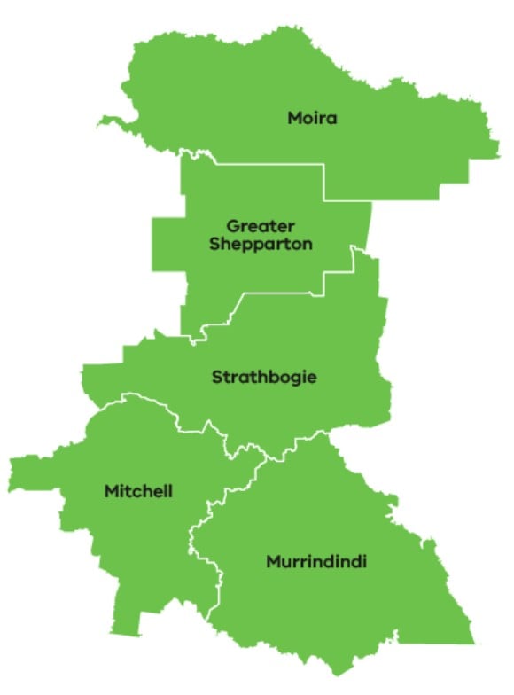
The Goulburn region falls largely within the Goulburn and Broken catchment areas and is well known for its fertile soils, mild climate and, good water resources. It extends from the northern fringe of Melbourne to Victoria’s border with New South Wales, the Murray River. Forested and hilly upland areas in the southeast give way to flatter areas and floodplains in the north.
Goulburn is often described as the “food bowl of Australia”, with agricultural production including dairy, livestock, horticulture (fruit, nuts, olives and grapes), cereals and other broadacre cropping. The north of the region includes a large irrigation area, the Goulburn Murray Irrigation District, which has typically supported dairy and horticulture. These industries are integrated into local supply chains that include processing, manufacturing and distribution, all contributing to the regional economy and employment opportunities.
The Goulburn Drought Resilience Plan was produced collaboratively by a wide range of local residents, groups and organisations. A Drought Resilience Reference Group was established to steer the Plan’s development and included key stakeholders with expertise in agriculture, regional development, water, governance, community and natural resource management.
Implementing activities in Goulburn
Goulburn Broken Catchment Management Authority (CMA) is the Phase One Plan Coordinator for the Goulburn region, receiving a $380,000 Implementation Grant to coordinate and deliver resilience building activities across the region.
Goulburn Broken CMA have delivering 6 activities:
- Expand farmer health service connections based on the Yea Saleyards Health Clinics Model – evaluating the success to date of the Yea Saleyards Farmer Health Clinic Project and recommending ways to replicate the model in other locations and for other demographics. The Yea Saleyards Farmer Health Clinic Project provided free health checks and had been successful in early identification of health risks, promoting additional clinical interventions and increasing access to allied health services.
- Mitigating impacts of drought on community sporting recreation reserves – documentation of how local governments in the Goulburn region plan for and access water to maintain their community recreation reserves during drought conditions. It identifies current issues and risks around water availability and investigates potential mitigation strategies like alternative water sources and infrastructure upgrades.
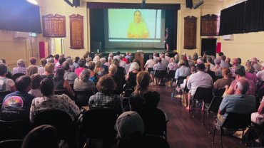
- Mental health first aid training and awareness – boosting mental health first aid awareness and skills in agricultural communities and schools through free screenings of the film ‘Just A Farmer’. The free screenings were designed to bring people together and provide information about locally available mental health supports and services. Five screenings across the Goulburn attracted over 500 community members.
- Web-based resources hub – establishing a centralised Goulburn Drought Resilience Plan information hub, to strengthen community connection, coordination, and access to drought-related resources. The hub aims to create consistent messaging, prevent duplication, and link regional organisations through shared branding and integration of online information and resources.
- Investigate research, development and extension (RDE) gaps – identifying gaps in drought preparedness and resilience through stakeholder workshops and engagement, focusing on RDE needs relevant to the Goulburn region. The activity is creating a shared understanding of priorities and investment opportunities to support targeted research for the Goulburn region.
- Encourage and support on-farm drought resilience and preparedness activities – building capacity across the region for farmers to adopt land management practices that build the resilience of the landscape to drought. Riverine Plains lead a project to support farmers to adopt practices that protect soils and enhance soil moisture retention, and Vic No Till conducted soil pit demonstrations on different soils interact, react and respond to management, moisture, and climate.